Wondering if you can actually live with less driving in Denver without moving to the middle of downtown? You are not alone. Many buyers want a neighborhood where daily life feels easier, with practical access to transit, walkable streets, and bike connections that help you rely less on a car. This guide breaks down what car-light living really looks like in Denver, which neighborhoods are useful places to start, and how to evaluate an area before you buy. Let’s dive in.
What car-light living means in Denver
In Denver, car-light living is bigger than being near a train stop. The city’s planning framework describes complete neighborhoods as places shaped by land use, mobility, and quality-of-life infrastructure, including walkable streets and convenient services. RTD’s transit-oriented development guidance also defines these areas as pedestrian-oriented environments within a five- to ten-minute walk of transit.
That matters because a neighborhood works best when several pieces fit together. You want transit access, yes, but you also want streets that are easy to walk, bike routes that fill short gaps, and a daily-life corridor that makes errands simpler. In other words, the best car-light setup is usually a mix, not a single feature.
Why transit alone is not enough
It is easy to assume rail is the gold standard and everything else is secondary. In practice, Denver’s bus, rail, bike, and walking networks often work together, and some neighborhoods function well because they have a strong corridor rather than a single rail station. That is especially true in places where frequent bus service connects you to multiple destinations.
Denver’s official bike map reinforces that point. The city distinguishes protected bike+ lanes, buffered bike+ lanes, bike+ lanes, neighborhood bikeways, shared streets, and multi-use trails. It also notes that RTD buses have bike racks and that bikes are allowed on RTD trains, which makes hybrid trips more realistic for short errands or longer commutes.
Downtown and Union Station
If you want the clearest example of car-light living in Denver, start with downtown, LoDo, Union Station, and Civic Center. Union Station Transit Center serves 14 bus routes and 6 rail lines, making it the strongest multimodal hub in the city based on the source material. That concentration gives you more ways to move around without relying on one route alone.
The 16th Street FreeRide adds another useful layer. RTD says this no-fare downtown service runs seven days a week between Union Station and Wade Blank Civic Center Station, with service every 4 to 12 minutes depending on time of day. For day-to-day movement inside the core, that kind of frequent service can make a real difference.
Street design also supports the area’s car-light appeal. Denver upgraded 15th and 17th Streets with dedicated transit lanes, high-visibility crosswalks, and protected bike separation, and RTD says nearly sixty buses per hour use those streets at the busiest times of day. If your goal is a walk-first environment with strong transit and bike connections, this part of Denver is the most obvious place to look.
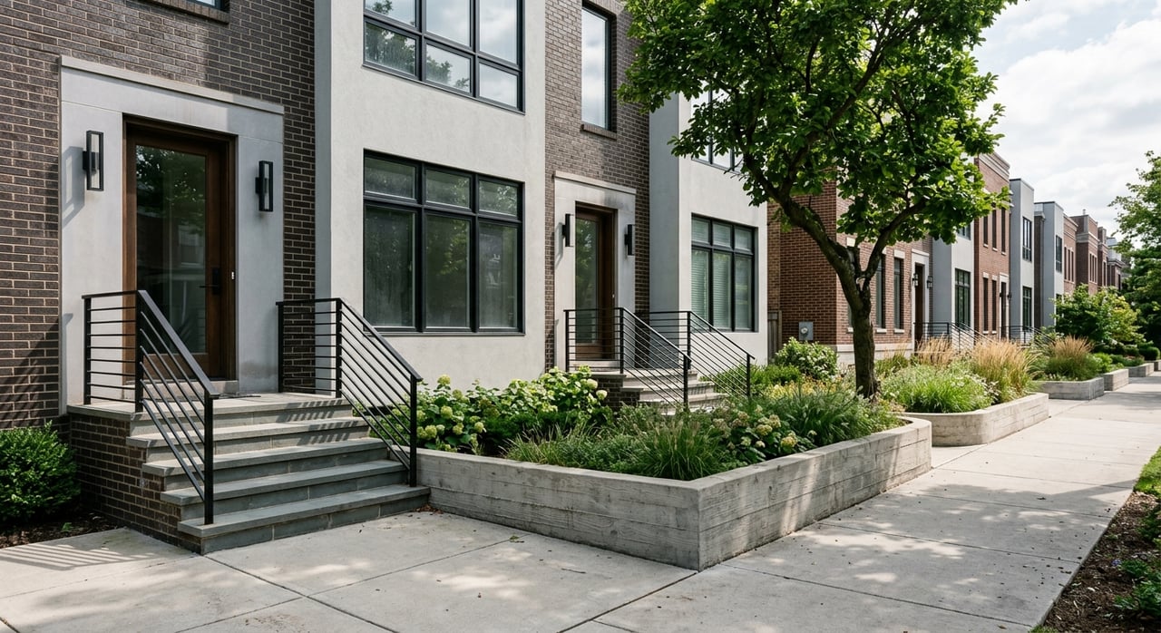
South Broadway and Baker
You do not need to live downtown to reduce how often you drive. South Broadway and Baker are strong examples of a corridor-based car-light lifestyle, where the value comes from a transit spine that connects several important destinations. That can be just as useful as living next to rail, depending on where you need to go.
RTD’s Route 0 Broadway links Englewood Station, Broadway/Evans, I-25 & Broadway, Lincoln/Alameda, Colfax/Broadway, Lawrence/16th, and Union Station. I-25 / Broadway Station also adds D, E, and H rail service plus bus routes 0, 11, and 14. RTD schedules also show Route 0B South Broadway and Route 0L South Broadway Limited, which gives this corridor multiple transit options rather than a one-line setup.
For buyers, the takeaway is simple. If your routine follows the Broadway corridor, this area may support car-light living better than you expect. It is a good reminder that bus-connected neighborhoods can be highly functional when the route actually matches your real destinations.
Five Points, RiNo, and Cole
If you want access to urban Denver without being right in the downtown core, the inner northeast side offers another strong example. Five Points, RiNo, and Cole benefit from several transit touchpoints that can stack together in a relatively small area. That makes these neighborhoods worth a closer look for buyers who want flexibility.
30th / Downing Station serves the L line and bus routes 12, 28, and 38. 38th / Blake Station serves the A line and bus routes 7 and 12. Route 12 South Downing ties key points together with stops at 38th & Blake, Downing & Colfax, Louisiana / Pearl Station, Evans, and Englewood.
This kind of network matters because it gives you options. A neighborhood becomes more usable when rail, bus, and corridor access overlap instead of forcing every trip onto one route. For many buyers, that flexibility is what makes a car-light routine feel realistic rather than theoretical.
West Colfax and west-side access
West Colfax is another area to keep on your radar if you want transit access without choosing downtown. On the west side, the W line and local bus service create a practical backbone for car-light living. That makes the corridor relevant for buyers who want stronger connections while keeping a different neighborhood feel.
Decatur-Federal Station serves the W line, four bus routes, and a FlexRide. Knox Station serves route 1 and the W line, and Perry Station serves the W line. RTD’s Route 16 West Colfax adds another useful corridor connection in this part of the city.
For buyers comparing west-side options, this is a helpful reminder that rail edges can still support daily mobility. You may not have the same density of choices as downtown, but you can still build a workable routine around a rail line plus local bus service.
How to evaluate a Denver neighborhood
The best way to evaluate car-light living is to start with maps, not impressions. Denver’s official neighborhoods map helps define the area you are considering, while RTD’s system map shows the broader bus and rail network. RTD Next Ride adds real-time vehicle positions, route cards, and alert status, which helps you test whether a route is practical in everyday life.
A useful review process can be simple:
- Find the nearest transit stop or station
- Check whether the route goes where you actually need to go
- Look at how easy the walk is from home to that stop
- Review the bike network for protected lanes, neighborhood bikeways, or trails
- See whether daily errands fit within that walking and biking pattern
Denver’s planning documents support this kind of approach. Blueprint Denver says complete neighborhoods should include walkable streets and convenient services. The Downtown Area Plan emphasizes walkability along with transit and bicycle access, and the West Area Plan prioritizes sidewalk improvements near high-frequency transit access points and within 600 feet of a rail station, bike-share station, or high-frequency bus stop.
Questions to ask before you buy
When you tour a neighborhood, it helps to focus on your real routine instead of an idealized one. A station nearby sounds great, but it only adds value if the route works for your job, errands, and social life. The same goes for bike infrastructure. A map line matters most when it actually closes the gap between home and your common destinations.
Ask yourself questions like these:
- Can you reach your workplace or common destinations on one useful route?
- Is the walk to transit direct and comfortable?
- Do bike lanes or trails help with short trips?
- Are errands possible along the same corridor?
- If one route is delayed, do you have a backup option?
This is also where local guidance can help. If you are buying in Denver with car-light goals, it helps to compare neighborhoods through your actual schedule, not just broad labels like walkable or transit-friendly.
Keep current conditions in mind
One important caveat is that transit conditions change. RTD’s Service Alerts page posts detours, delays, stop closures, and elevator outages, and RTD says alerts appear in Next Ride and on its website when service is delayed for more than 20 minutes. RTD also has an active downtown rail reconstruction project, so exact stop patterns should not be treated as fixed.
East Colfax is also in transition. RTD said in 2026 that East Colfax BRT construction is underway, that the project began in 2024, and that full service is expected in 2028. RTD also said the new center-running system is intended to replace the existing 15 and 15L routes.
That does not make these areas less relevant. It simply means you should verify current service before making a decision. In a changing system, the best neighborhood for you is the one that works now and still makes sense as projects move forward.
The bottom line for Denver buyers
Car-light living in Denver is possible in more than one kind of neighborhood. Downtown and Union Station are the most obvious walk-first example, but South Broadway, Baker, Five Points, RiNo, Cole, and West Colfax also show how bus corridors, rail access, bike networks, and walkable daily destinations can work together.
If you are searching for a home with fewer car trips in mind, focus on how the neighborhood supports your real day-to-day life. Transit access matters, but so do street design, bike connections, and whether errands fit naturally into your routine. If you want help narrowing down Denver neighborhoods that match the way you actually live, The Colorado Agents can help you compare options with a practical, local lens.
FAQs
What does car-light living in Denver actually mean?
- It usually means living in a neighborhood where walking, transit, and biking can handle a meaningful share of your daily trips, not necessarily living completely car-free.
Which Denver neighborhoods are useful for car-light living?
- Based on the local transit and planning sources here, strong examples include downtown, LoDo, Union Station, Civic Center, South Broadway, Baker, Five Points, RiNo, Cole, and parts of West Colfax.
Do you need to live downtown for car-light living in Denver?
- No. Downtown is Denver’s clearest multimodal example, but other areas can work well when they combine useful bus or rail access with walkable streets and bike connections.
Is rail better than bus for Denver car-light living?
- Not always. In Denver, some neighborhoods function well because of strong bus corridors, multiple route options, and connections to rail, not because of rail alone.
How should you evaluate a Denver neighborhood for living with less driving?
- Start with the nearest transit stop, confirm the route matches your real destinations, check the walking path, and review whether bike lanes or trails help fill short-trip gaps.
Are Denver transit conditions stable when choosing a home?
- Not completely. RTD posts alerts for detours, delays, stop closures, and elevator outages, and some corridors and downtown rail patterns are changing due to active projects.